The impending arrival of a polar vortex in early January 2024 is poised to bring freezing temperatures to Northern Florida and the Panhandle, a concerning development for residents and visitors alike. This weather event, characterized by the southward expansion of a band of strong winds in the stratosphere above the North Pole, is predicted to drive frigid air across the United States, plunging temperatures in the Sunshine State to potentially their lowest point of the year. This forecast represents a significant departure from Florida’s typically mild winter climate, posing challenges and risks for the state’s population and infrastructure.
The anticipated freezing temperatures raise significant concerns for Florida, a highly populous state and a popular winter destination for those seeking refuge from colder northern climates. The potential for ice and snow carries implications for travel safety, potentially leading to widespread disruptions and hazardous road conditions. Daily activities could also be significantly impacted, with school closures a likely consequence. Furthermore, the projected drop in temperatures poses serious health risks, particularly for vulnerable populations such as infants and the elderly, who are more susceptible to cold-related illnesses.
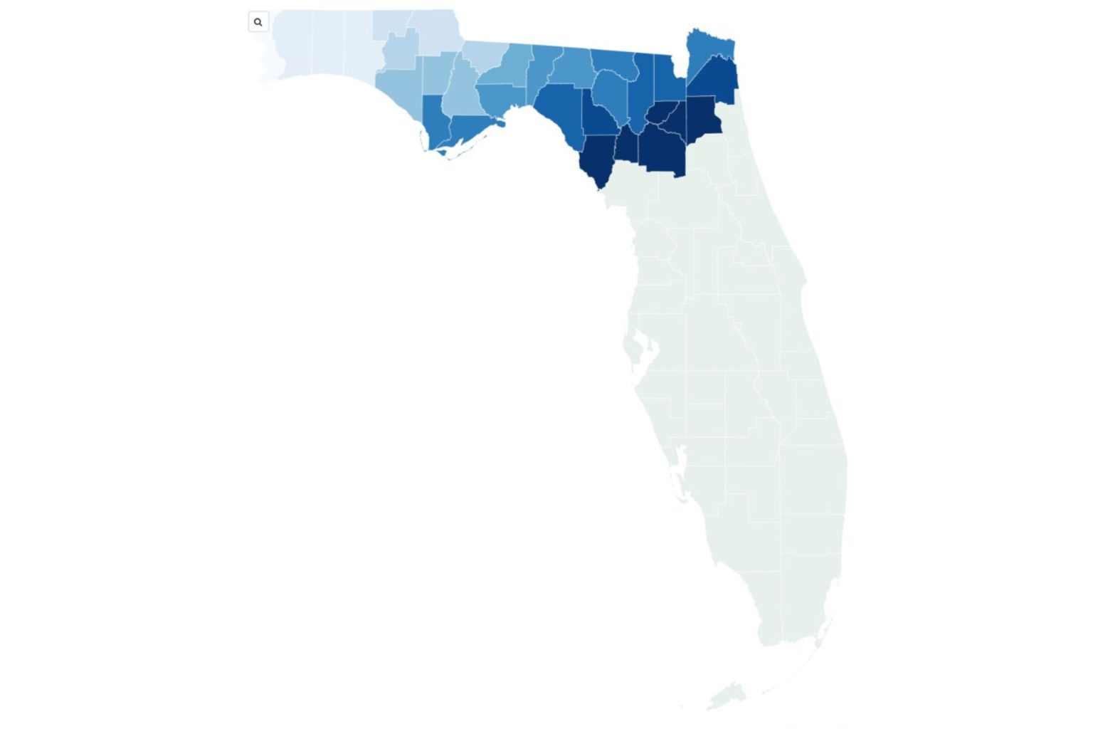
Meteorological data paints a stark picture of the impending cold snap. Forecast models, including those from Pivotal Weather utilizing data from the European Center for Medium-range Weather Forecasts, predict temperatures below 32 degrees Fahrenheit across a large swathe of northern and northwestern Florida counties during the first week of January. Several counties, including Santa Rosa, Okaloosa, Walton, Holmes, and Jackson, are projected to experience wind chills in the low 20s. While temperatures are expected to be marginally higher further south, counties like Gilchrist, Alachua, and Bradford will still experience temperatures hovering just above freezing. These predictions, while subject to change, underscore the severity of the anticipated cold wave.
The impact of this unusual cold front extends beyond inconvenience. The freezing temperatures could damage sensitive crops, particularly citrus fruits, a major agricultural product in Florida. The influx of cold air could also negatively impact marine life, stressing manatees and other species accustomed to warmer waters. Furthermore, the increased demand for heating could strain energy resources, potentially leading to power outages in affected areas. The combination of these factors makes the approaching polar vortex a significant economic and ecological concern for Florida.
The National Weather Service (NWS) and other meteorological experts are closely monitoring the situation and urging the public to prepare for the cold weather. Recommendations include dressing in layers, checking on vulnerable neighbors and family members, and protecting exposed pipes to prevent freezing. Staying informed about the latest weather updates is crucial, and the NWS advises regularly checking their website or local news sources for the most current information. While the polar vortex itself is a normal meteorological phenomenon, its southward reach and the potential for freezing temperatures in Florida warrant heightened attention and preparation.
The impending polar vortex highlights the importance of preparedness and underscores the potential impact of extreme weather events, even in typically mild climates. While the full extent of the cold wave’s impact remains to be seen, the current forecasts emphasize the need for residents, visitors, and state officials to take proactive measures to mitigate potential risks and ensure the safety and well-being of all affected. The situation warrants continued vigilance and a commitment to staying informed and prepared throughout the duration of the cold weather event.

