Paragraph 1: A Stormy Holiday Prelude:
The festive cheer of the upcoming holiday season is set to encounter a turbulent weather front as a series of storms are poised to sweep across major swathes of the US just before Christmas. This unwelcome meteorological guest threatens to disrupt travel plans for millions embarking on holiday journeys by road and air. While the Upper Midwest might experience a relatively calm weather spell, other regions, particularly in the eastern half of the country, should brace for a mix of heavy rain, snow, and potentially freezing rain, starting from the final full workweek before Christmas.
Paragraph 2: Early Week Disturbances:
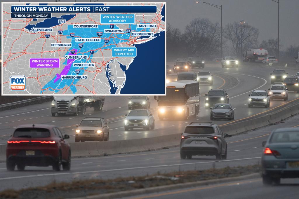
The week commences with a cold front extending from the Great Lakes down to the southern Plains on Monday. As it progresses eastward, this front will gradually weaken, though not before leaving its mark on the Northeast. Winter weather alerts are in effect for regions spanning from the Great Lakes to the Mid-Atlantic and Northeast. Residents can expect a combination of rain, snow, and possibly freezing rain, beginning Sunday and persisting through Monday. While higher elevations in the interior Northeast and Mid-Atlantic are more likely to experience snowfall, areas closer to the bustling Interstate 95 corridor will primarily contend with rainfall.
Paragraph 3: Midweek Deluge:
Following the initial cold front, a more potent low-pressure system is expected to take shape over the Tennessee Valley. This system will bring several inches of rain to sections of the lower Mississippi, Tennessee, and Ohio valleys by midweek. As it advances towards the Mid-Atlantic, this system will unleash significant rainfall along its path, with Wednesday anticipated to bear the brunt of the impact as the system intensifies while moving offshore.
Paragraph 4: Return of Winter’s Chill:
In the wake of this midweek downpour, colder air will surge back into parts of New England and the Northeast. This could result in further snowfall, particularly in areas that have already experienced heavy snow accumulation in recent weeks. The exact extent of this snowfall remains uncertain, but the potential for further winter weather disruptions adds another layer of complexity to holiday travel plans.
Paragraph 5: Looming Uncertainty for Late Week:
While the immediate weather forecast is relatively clear, longer-term predictions remain shrouded in uncertainty. There are indications that a potentially impactful winter storm could develop and target the East Coast towards the latter half of the week, specifically Thursday and Friday. However, details about this potential storm are still scarce, and computer forecast models only provide a general indication of precipitation spreading across the East Coast during this period. The specific trajectory, intensity, and precipitation type associated with this potential storm remain to be determined.
Paragraph 6: Staying Informed Amidst Uncertainty:
As holiday travelers grapple with the possibility of weather-related disruptions, staying informed about the evolving forecast is crucial. The FOX Weather app provides a valuable resource for real-time updates and notifications about changing weather conditions. By enabling notifications, travelers can receive timely alerts about potential delays or disruptions, allowing them to adjust their plans and make informed decisions about their journeys. This proactive approach can help mitigate the impact of inclement weather and ensure safer and smoother holiday travels.

