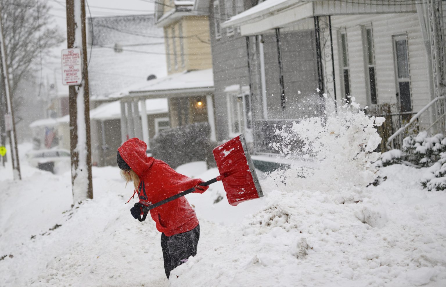
A powerful arctic blast has gripped the eastern half of the United States, bringing with it heavy lake-effect snow, dangerously low wind chills, and hazardous travel conditions. Stretching from Minnesota to northern Florida and up through New England, the frigid air mass has caused temperatures to plummet, creating a stark contrast to the milder conditions typically experienced in early winter. The most significant snowfall has been concentrated in western New York, where some areas have been buried under as much as 3.5 feet of snow, and in northern Lower Michigan, which has seen accumulations of up to 20 inches. Strong winds, gusting up to 40 mph, have exacerbated the situation, leading to whiteout conditions and severely reduced visibility. Lake-Effect Snow Warnings remain in effect for portions of Ohio, Pennsylvania, and western New York, where an additional 6 to 12 inches of snow is possible. Wind chills have dipped below zero in Minneapolis, hovered near zero in Chicago, and remained in the teens across the Northeast. Even the Southeast has experienced a significant chill, with temperatures near freezing and Frost Advisories issued for northern Florida and southern Georgia.
Adding to the complex weather pattern, a new storm system is moving into the Plains and Midwest, bringing the threat of freezing rain and treacherous icy conditions. Ice Storm Warnings are in place for Iowa, while Icy Alerts extend from Kansas to Minnesota. The primary concern with this system is the potential for a significant glaze of ice to accumulate on roads and other surfaces, making travel extremely dangerous. Cities such as Des Moines, Minneapolis, and Omaha are under alerts, and residents are strongly discouraged from traveling unless absolutely necessary. The icy conditions are expected to persist through Saturday morning, creating a prolonged period of hazardous travel.
Meanwhile, the western United States is bracing for a series of storms that will bring heavy snow and rain through the weekend. The Sierra Nevada mountains in California have already been impacted by one storm, which has dumped up to half a foot of snow, causing accidents and traffic backups on major thoroughfares like I-80. However, a more potent storm is looming, expected to arrive later Friday, bringing even heavier precipitation. This new storm will unleash heavy rain and mountain snow across a wide swath of the West, from Washington to California. Winter Storm Warnings have been issued for the California mountains, where snowfall accumulations could reach up to 4 feet. Northern California is also at risk for significant rainfall, with up to 5 inches possible and a Flood Watch in effect.
The impending storm system affecting the West Coast is characterized as an atmospheric river, a phenomenon described as a “river in the sky.” These narrow bands of concentrated water vapor transport vast amounts of moisture from tropical regions to higher latitudes, often resulting in significant precipitation events. The National Weather Service (NWS) has highlighted the potential of this atmospheric river to deliver 15 times the amount of water vapor carried by the Mississippi River in liquid form. Coupled with a second storm, this atmospheric river poses a substantial threat of flooding, power outages, and hazardous travel conditions across California, Oregon, and Washington. The NWS and AccuWeather have issued warnings, urging residents to prepare for the potential impacts of these powerful storms.
The simultaneous occurrence of these distinct weather events across the country underscores the dynamic nature of weather patterns and the potential for significant disruptions. The arctic blast affecting the East, the ice storm developing in the Plains and Midwest, and the atmospheric river headed for the West Coast each present unique challenges and hazards. Staying informed about the latest weather updates and heeding warnings issued by authorities is crucial for ensuring personal safety and minimizing the risks associated with these severe weather events. Continuous monitoring of weather forecasts and adhering to travel advisories will be essential in navigating these challenging conditions.
The contrasting weather patterns impacting different regions of the United States highlight the complex interplay of atmospheric forces. While the eastern half of the country shivers under an arctic blast, the western states prepare for a deluge of rain and snow. The central part of the nation faces the treacherous threat of freezing rain and icy conditions. These diverse weather events underscore the importance of preparedness and the need to adapt to rapidly changing conditions. Understanding the nature of these weather phenomena and taking appropriate precautions can help mitigate the potential risks and ensure safety during these periods of severe weather.

