A significant shift in temperatures is anticipated across the United States, offering respite from the recent arctic blast that has gripped the nation. Over 240 million Americans will experience a warming trend, with temperatures predicted to surge 10-15 degrees above average in many regions. This marks a dramatic departure from the prevailing below-average temperatures that have characterized the early days of December. While not quite summer-like, the milder conditions will be a welcome change for many. Cities like Chicago and New York City can expect highs in the 50s, a significant jump from recent frigid temperatures. However, the warmth will be fleeting, as another potent cold front is forecast to sweep across the country by midweek, plunging temperatures back down and reminding everyone that winter is far from over.
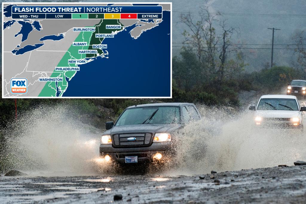
While the warmer temperatures are welcomed, they also bring a potential threat of flooding, particularly in the Northeast. The rising temperatures, combined with anticipated heavy rainfall, will accelerate snowmelt, creating runoff that could overwhelm drainage systems and lead to localized flooding. This is especially concerning for areas near the Great Lakes, which were recently blanketed by heavy lake-effect snow. The combination of melting snow and several inches of rain could create significant challenges for communities in these regions. Therefore, while the warmer temperatures provide a temporary reprieve from the cold, they also necessitate careful monitoring of water levels and preparedness for potential flooding.
The much-needed rain, while beneficial for alleviating drought conditions that have plagued the region and fueled wildfires, also presents a double-edged sword. The Northeast and New England are expecting significant rainfall, with some areas potentially receiving several inches. This precipitation, while helpful in mitigating drought concerns, could exacerbate the flood risk due to the rapid snowmelt. The I-95 corridor, stretching from New York City through Providence and Boston, is expected to receive a substantial amount of rainfall. Although this will contribute to easing the long-term drought, the immediate concern remains the potential for flooding.
The anticipated rainfall will occur in two main waves. The first round is expected on Monday afternoon, primarily affecting areas west of the I-95 corridor, including cities like Pittsburgh, Columbus, and Charleston. While this initial rainfall won’t be as prolonged as the later showers, it will still contribute to the snowmelt. By Monday evening, the heavier rain will move eastward, impacting the I-95 corridor during the evening rush hour. This heavier rain, coupled with the ongoing snowmelt, increases the risk of flooding in areas near Lake Erie and Lake Ontario.
The second, more significant round of rain is predicted for midweek, particularly on Wednesday. This rainfall is expected to be much more widespread and intense, prompting the National Oceanic and Atmospheric Administration’s Weather Prediction Center (WPC) to issue a Level 2 out of 4 flood risk for a large swathe of the Northeast, from Connecticut to Maine, including Boston. This heavier rainfall, combined with the accumulated snowmelt from earlier in the week, significantly elevates the risk of widespread flooding throughout the region.
Following the midweek rainfall, the return of colder air will likely cause the rain to transition to snow in some parts of the interior Northeast. However, predicting the exact location and accumulation of snowfall is challenging due to the saturated ground and relatively warm temperatures preceding the winter weather. The combination of heavy rain and subsequent snow could further complicate the situation, potentially leading to a mix of flooding and winter weather hazards. Therefore, it is essential to stay updated on the latest weather forecasts and prepare for the possibility of rapidly changing conditions.


